Menu

Show posts

This section allows you to view all posts made by this member. Note that you can only see posts made in areas you currently have access to.

Show posts Menu

Messages - Tronpo

#1


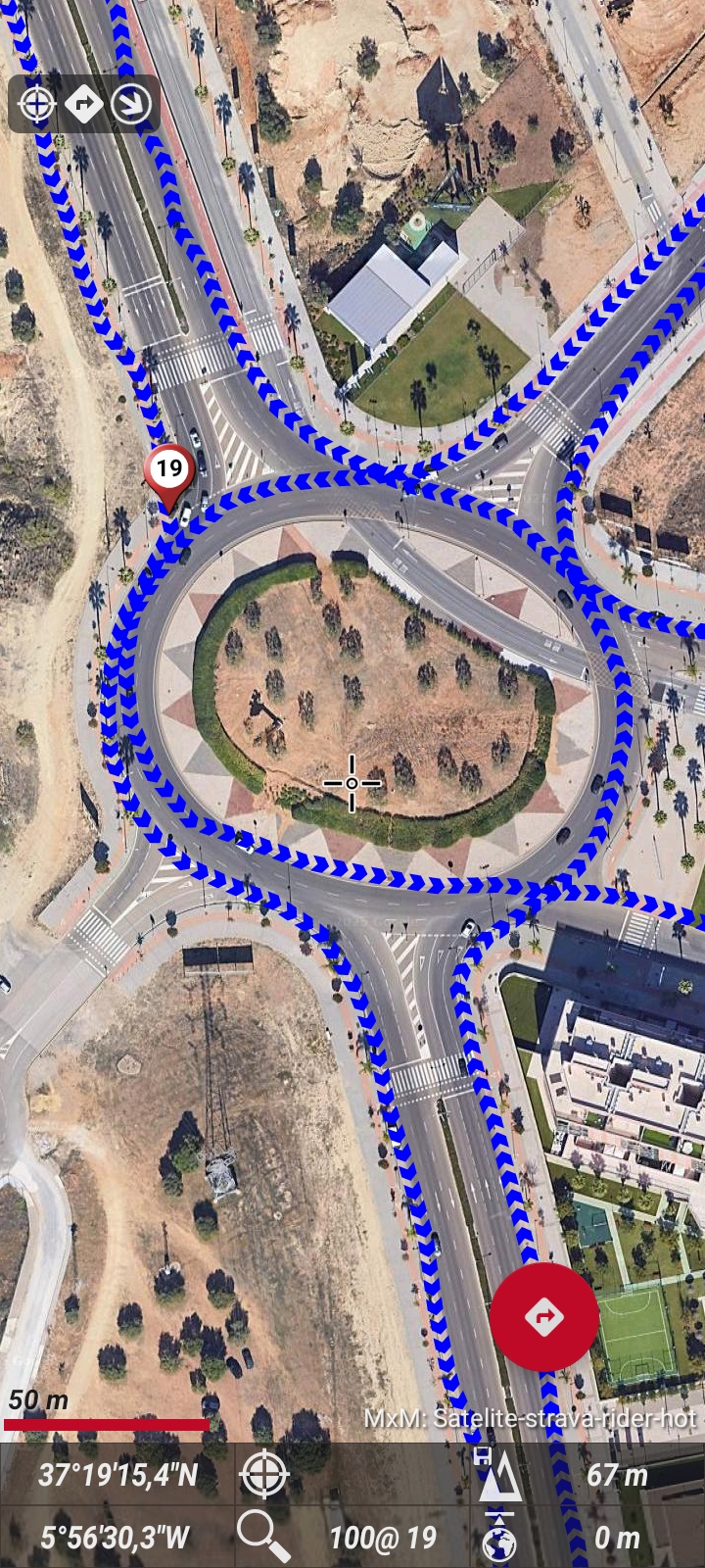
Hello, in track visuals, you can set the track direction to be shown with arrows.

Best regards
#2
Hi, look at the app'> storage settings.
Here you'll see the directories that oruxmaps are using on Android 14. Is there where you have your maps placed?
Are you using private memory android / data ? If so, the app does not have access to the SD card.
You have to give access to all the File  . You have the option on that same settings screen.
Best regards
#3


An example of the big picture and the bigger letters

And here the little

Best regards
#4
Quote from: thewisa on February 10, 2025, 02:37:57 PMThe fields in the dashboard (also the trip computer) is not big enough for cycling.

It would be great to have the option to make the Dasboard larger even if the map space would be reduced, since cycling along a planned route does not require a large map, but rather easy and quick reading of the data fields. And when cases arise where the full map is needed, a simple tap already hides the data fields!

It could be further improved by adding a second dashboard with the same number of fields of the main dashboard, making it possible to alternate between them by sliding them sideways.

As a cyclist we already love the climb feature and the option to see the next climb profile below the dashboard, but we miss the data during that climb and could be solved adding a second dashboard as requested before with that data of the climb ahead (gain left, distance left, etc), appearing automatically when the climb starts ;)

Thank you for all the improvements you have done already :)
Hello in visual settings > dashboard you have the option to choose a larger dashboard and also a very large font size for the fields. Do you mean even bigger than all this?
Greeting
#5
BETAS / Re: New beta 11.x
February 06, 2025, 02:56:28 PM
He adds that deleting segments using the side swipe also doesn't work.
#6
BETAS / Re: New beta 11.x
February 01, 2025, 01:27:37 PM
Hola !! Un amigo encontró el problema , estas usando el modo claro en la app verdad? Los botones si existen pero son blancos como el fondo 🤣🤣🤣, pulsa donde debería estar el botón y verás como so esta.
Puedes cambiar al modo oscuro y comprobar lo que te digo .

Saludos
#7
BETAS / Re: New beta 11.x
January 31, 2025, 05:06:44 AM
Quote from: Lectivo on January 31, 2025, 01:26:18 AMExacto, eso justo. Que no se por que no me deja modificar. Creo que es porque no me sale el boton de OK
Extraño...Prueba con otro perfil , o a instalar de nuevo .
#8
MEJORAS/NEW FEATURES / Re: Improvements for Maps
January 30, 2025, 03:30:02 PM
I'm glad we understand each other.👍
#9
BETAS / Re: New beta 11.x
January 30, 2025, 02:29:16 PM
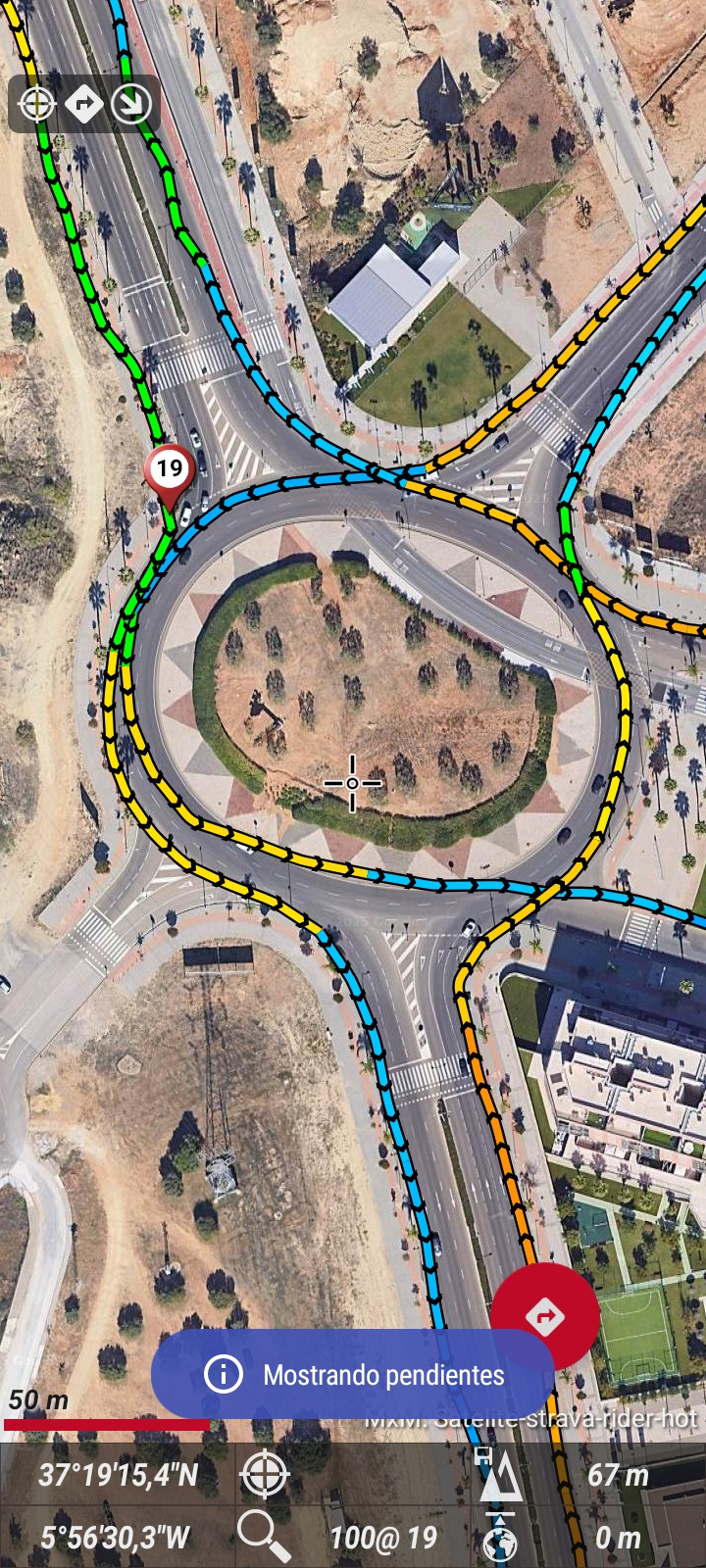
Quote from: Lectivo on January 30, 2025, 12:53:12 AMHola,

En las ultiomas versiones hay un problema que impide cambiar la "pendiente maxima (%)" en "Trazo coloreado pendiente".

Sale por defecto un valor de 46, y por lo que sea, no es posible cambiar. En la version GP si que funcionaba bien.

Gracias!!

Hola , te refieres en configuración >elementos visuales > tracks ?

Aquí ?
#10
MEJORAS/NEW FEATURES / Re: Improvements for Maps
January 30, 2025, 12:38:55 PM
TI add another example, I have maps of an area that join each other at a point. It wouldn't be better to be able to see all 4 at once when I'm in that common point
#11
MEJORAS/NEW FEATURES / Re: Improvements for Maps
January 30, 2025, 10:41:51 AM
Hello, at no time will I be the one to question the intelligent operation of OruxMaps, the GP and 7.428 versions work the same.
I will try to explain myself better so that my request for improvement is visually seen.
In the Hour of working with maps divided from the same area and housed in the same subfolder.
Currently the map is shown (part of 1 of 4 in this case)

When we scroll it will automatically show the other map (part 2 of 4 )

Knowing that we have all parts of the map (4 of 4)
Wouldn't it be better if they were shown together, without scrolling around the map?


The first two images are offline maps, the last one is online map, I use the latter to make the simulation of how the two offline maps shown at the same time would look
Best regards
#12
MEJORAS/NEW FEATURES / Improvements for Maps
January 29, 2025, 09:39:55 AM
Hola orux !! Dejo aquí algunas sugerencias sobre posibles mejoras respecto a las funciones de mapas en nuestra app. (bajo mi punto de visto y uso )

Mejoras de lo existente.
Mapas
1-Mapas descargados divididos en zonas.
Actualmente: OruxMaps actúa de dos formas diferentes. Si por ejemplo están guardados en una misma subcarpeta cambia del A a B automáticamente al cambiar la ubicación o el centro de pantalla, pero si no están en una misma subcarpeta al salir de zona sale un cuadrado preguntando qué mapa seleccionar, parece algo molesto para quienes no lo sepan.
Ideal: lo mejor sería que los mapas divididos en zonas se mostraran a la vez , solapados .
Cuando están agrupados en una subcarpeta
2- Mapsforge
-Los temas Mapsforge ofrecen mejor rendimiento para el mapa qué son diseñados , por ejemplo los temas Freizeitkarte para los mapas Freizeitkarte , los temas de Openandromaps para los mapas de Openandromaps , en OruxMaps se puede usar cualquier tema Mapsforge con los cualquier mapa Mapsforge , esto no es lo ideal , no ofrecen la información correcta o no toda la información , además si fuera posible que al abrir un mapa Mapsforge recordará el último tema utilizado para ese mapa.
3-información del mapa , sería interesante y útil poder obtener información del mapa descargado desde el listado de mapas , por ejemplo en los tres puntitos la  Fecha de creación,ejemplo (los Mapsforge la tienen y mbtiles ing)
4-Creador de mapas
Recordar área descargada para una próxima descarga , o poder actualizar esa misma área.
Seleccionar varias fuentes para la descarga programada de un mismo área .
5-Listados de mapas
Los listados de mapas online wms wmts por defecto bienen con todo...es saturador,incómodo de manejar. Sería mucho mejor que se vean vacíos y poder añadir los mapas que ofreces desde una biblioteca algo como el directorio de wms/wmts (esto esta muy oculto la mayoría no sabe que existe.
Para los que no saben editar los archivos no pueden deshacerse de los mapas por defecto, ya que al refrescar los listados todo vuelve.

Improvements to Existing Features:
Maps
 * Zoned Downloaded Maps:
   Currently: OruxMaps operates in two different ways. If, for example, they are saved in the same subfolder, it automatically switches from A to B when changing the location or center of the screen, but if they are not in the same subfolder, when exiting the zone, a square appears asking which map to select, which seems somewhat annoying for those who don't know.
   Ideal: The best would be for the zoned maps to be displayed at the same time, overlapping.
   When grouped in a subfolder:
 * Mapsforge:
   -Mapsforge themes offer better performance for the map they are designed for, for example, Freizeitkarte themes for Freizeitkarte maps, Openandromaps themes for Openandromaps maps. In OruxMaps, you can use any Mapsforge theme with any Mapsforge map, this is not ideal, they do not provide the correct information or not all the information, also if it were possible that when opening a Mapsforge map it would remember the last theme used for that map.
 * Map information: It would be interesting and useful to be able to obtain information about the downloaded map from the map list, for example in the three dots the creation date, for example (Mapsforge has it and mbtiles ing)
 * Map creator:
   Remember the downloaded area for a future download, or be able to update that same area.
   Select multiple sources for the scheduled download of the same area.
 * Map lists:
   Online map lists wms wmts by default come with everything...it's overwhelming, inconvenient to handle. It would be much better if they appeared empty and you could add the maps you offer from a library, something like the wms/wmts directory (this is very hidden, most people don't know it exists).
   For those who don't know how to edit files, they can't get rid of the default maps, as when refreshing the lists everything comes back

Saludos !!
#13
Hello, maybe you didn't clear the cache? And the elements They were shown as before the change.
In track properties > segments > edit segments.
You can also adjust the individual thicknesses.
Whenever you make changes, delete what's on the map and load again to see the new settings.
Best regards
#14
GENERAL / Re: OruxmapsGP sin Google Play
January 28, 2025, 05:17:09 AM
Hello!! Well, Did the test, it is indeed necessary to have the session open in the play store.
I think it is a requirement that the play store stores Amazon store Huawei gallery use, for the authenticity verification of the apps
Best regards
#15
GENERAL / Re: OruxmapsGP sin Google Play
January 27, 2025, 02:23:36 PM
Ok, then I'll try logging out of Google To verify . Close cession on Google play and all Google accounts, browse etc, right?
Te
Is there an error message ?